Zoom Earth - Live Weather Map 2.2
Free Version
Publisher Description


TRACK THE WEATHER IN REAL-TIME
Zoom Earth is an interactive weather map of the world and a real-time hurricane tracker.
Explore the current weather and see forecasts for your location through interactive weather maps of rain, wind, temperature, pressure, and more.
With Zoom Earth, you can track the development of hurricanes, storms, and severe weather, monitor wildfires and smoke, and stay aware of the latest conditions by viewing satellite imagery and rain radar updated in near real‑time.
SATELLITE IMAGERY
Zoom Earth shows weather maps with near real-time satellite imagery. Images are updated every 10 minutes, with a delay between 20 and 40 minutes.
Live satellite images are updated every 10 minutes from NOAA GOES and JMA Himawari geostationary satellites. EUMETSAT Meteosat images are updated every 15 minutes.
HD satellite images are updated twice a day from NASA polar-orbiting satellites Aqua and Terra.
RAIN RADAR & NOWCAST
Stay ahead of the storm with our weather radar map, which shows rain and snow detected by ground-based doppler radar in real-time, and provides an instant short-term weather forecast with radar nowcasting.
WEATHER FORECAST MAPS
Explore beautiful, interactive visualizations of the weather with our stunning global forecast maps. Our maps are continually updated with the latest weather forecast model data from DWD ICON and NOAA/NCEP/NWS GFS. Weather forecast maps include:
Precipitation Forecast - Rain, snow, and cloud cover, all in one map.
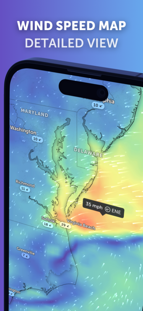
Wind Speed Forecast - Average speed and direction of surface winds.
Wind Gusts Forecast - Maximum speed of sudden bursts of wind.
Temperature Forecast - Air temperatures at 2 meters (6 feet) above the ground.
"Feels Like" Temperature Forecast - Perceived temperatures, also known as apparent temperature or heat index.
Relative Humidity Forecast - How air moisture compares to temperature.
Dew Point Forecast - How dry or humid the air feels, and the point at which condensation occurs.
Atmospheric Pressure Forecast - The average atmospheric pressure at sea level. Low-pressure areas often bring cloudy and windy weather. High-pressure areas are associated with clear skies and lighter winds.
HURRICANE TRACKING
Follow hurricanes from development to category 5 in real-time with our best-in-class tropical tracking system. Information is clear and easy to understand. Our hurricane tracking weather maps are updated using the very latest data from NHC, JTWC, NRL, and IBTrACS.
WILDFIRE TRACKING
Monitor wildfires with our active fires and heat spots overlay, which shows points of very high temperature detected by satellite. Detections are updated daily with data from NASA FIRMS. Use in conjunction with our GeoColor satellite imagery to see the movement of wildfire smoke and monitor fire weather in near real-time.
CUSTOMIZATION
Adjust temperature units, wind units, time zone, animation styles, and many more features with our comprehensive settings.
LEGAL
Terms of Service: https://zoom.earth/legal/terms/
Privacy Policy: https://zoom.earth/legal/privacy/
May 1, 2024
Version 2.2
- New! Radar Nowcast. The radar map now shows an instant rain forecast based on real-time data. Coverage is limited.
- Other Minor Fixes and Improvements.
About Zoom Earth - Live Weather Map
Zoom Earth - Live Weather Map is a free app for iOS published in the Astronomy list of apps, part of Home & Hobby.
The company that develops Zoom Earth - Live Weather Map is Neave Interactive. The latest version released by its developer is 2.2.
To install Zoom Earth - Live Weather Map on your iOS device, just click the green Continue To App button above to start the installation process. The app is listed on our website since 2024-05-01 and was downloaded 0 times. We have already checked if the download link is safe, however for your own protection we recommend that you scan the downloaded app with your antivirus. Your antivirus may detect the Zoom Earth - Live Weather Map as malware if the download link is broken.
How to install Zoom Earth - Live Weather Map on your iOS device:
- Click on the Continue To App button on our website. This will redirect you to the App Store.
- Once the Zoom Earth - Live Weather Map is shown in the iTunes listing of your iOS device, you can start its download and installation. Tap on the GET button to the right of the app to start downloading it.
- If you are not logged-in the iOS appstore app, you'll be prompted for your your Apple ID and/or password.
- After Zoom Earth - Live Weather Map is downloaded, you'll see an INSTALL button to the right. Tap on it to start the actual installation of the iOS app.
- Once installation is finished you can tap on the OPEN button to start it. Its icon will also be added to your device home screen.
